Yorkshire told there may still be more flooding misery on the way


Forecasters have warned that the possibility of heavy rain on already saturated ground after the wettest December on record means more flooding is likely in many of the areas hit last month.
Advertisement
Hide AdAdvertisement
Hide AdWeather warnings are in place across Yorkshire as well as in Wales, Scotland, Lancashire, Cumbria, Devon and Cornwall and the South East of England as the remnants of Storm Jonas head for the UK today.
The Environment Agency (EA) said areas already affected by record river levels, including Yorkshire, Cumbria and Lancashire, are likely to be at risk of flooding as heavy rain today and into Wednesday could cause river levels to rise and drains to flood.
Clare Dinnis, national flood duty manager at the EA, said they would issue flood warnings and alerts where necessary and warned people to be ready for flash flooding in some areas.
She said that people in Yorkshire “need to be prepared for the risk of flooding,” adding that “disruption to travel and some flooding of low-lying land and individual properties is possible.”
Advertisement
Hide AdAdvertisement
Hide AdThe Met Office has also issued yellow ‘be aware’ weather warnings for heavy rain and severe gales in Yorkshire, Cumbria and Lancashire, with forecasters predicting around 30mm to 50mm of rain in most parts and up to 100mm in exposed upland areas. Parts of Scotland are likely to face winds of up to 70mph.
A second weather front will see further rain and wind hitting the UK towards the end of the week.
But recent mild temperatures are expected to continue after one of the warmest January days on record on Sunday.
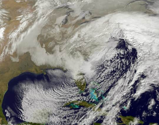
A Met Office spokeswoman said the weather is the remnants of the storm that brought blizzards and near record-breaking amounts of snow to the US.
Advertisement
Hide AdAdvertisement
Hide AdShe said: “We’re not going to get snowfall, it will just manifest itself as wet and windy weather because, as it travels over the Atlantic, it picks up moisture and warms up, which means it comes as rain rather than snow.
“What we have got is a lot of weather coming our way. We’ve got these warnings out for great swathes of the west coast of the UK, that’s for Tuesday into Wednesday, for potential heavy rain accompanied by strong winds as well. And because we’ve had so much rain falling on already saturated ground, some of the areas experiencing that will be the ones who have experienced flooding already.”
Thousands of homes and businesses across Lancashire, Cumbria and Yorkshire were ruined by Storm Desmond on Boxing Day, prompting mass evacuations from communities.
Read more...