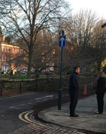
Your pictures show the aftermath of gales striking Wakefield


As residents battened down the hatches a tree was uprooted at St Johns Square in central Wakefield, while a floodlight was brought down at Sandal Tennis Club.
Warnings from the Met Office remain in place for snow and ice.
Advertisement
Hide AdAdvertisement
Hide AdThe Met Office Forecaster said: “A vigorous area of low pressure running southwards across the North Sea will be accompanied by a swathe of very strong winds which will affect many northeastern and extreme eastern areas of the UK.
“Ice is expected to form on untreated surfaces on Thursday night and last into Friday morning. In addition, some outbreaks of sleet and snow are likely to run quickly southwards on Friday morning, chiefly affecting parts of northern and eastern England, clearing the extreme southeast by late morning.”
Thanks to Paul Hawkhead and Richard Taylor for their pictures, keep sending them in.